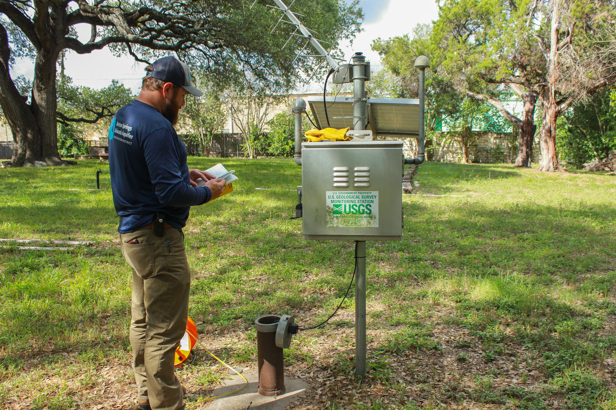
Justin Camp, District Hydrogeoloic Technician, measures the Lovelady monitor well in south Austin with an e-line in June of 2025.
For those who keep up with the District’s drought status, it’s common knowledge that the Lovelady monitor well is one of our two primary drought triggers. What you may not know is that it also provides key historical data regarding groundwater levels of the Barton Springs segment of the Edwards Aquifer over the last 74 years. With Lovelady currently hovering near the Stage IV Exceptional Drought threshold, we want to provide additional information on this monitor well and its role in providing a deeper understanding of the Edwards Aquifer within our territory.
Lovelady History
Lovelady monitor well is located five miles from downtown Austin on South 1st Street. The well gets its name from the Lovelady family who previously lived on the land, and the site’s first manual groundwater level measurement was obtained on July 29, 1949. Since there aren’t many Edwards Aquifer wells in that area, this well was, and continues to be, an important source of information regarding Edwards groundwater resources within the District’s territory.
For nearly 30 years, manual measurements were taken intermittently by the Texas Board of Water Engineers (which later became part of the Texas Water Development Board [TWDB] in 1965) for groundwater monitoring purposes. From 1978-1991, the TWBD and the US Geological Services (USGS) collaborated in taking manual measurements.
Lovelady as a Drought Trigger
Lovelady was identified as a potential drought trigger in 1990, soon after the District’s creation in 1987, based on the following rationale found in Smith et al:
“Barton Springs is a good measure of groundwater storage but is highly sensitive to the conduit flow system, responding quickly to minor and major recharge events. The Lovelady well is also a good measure of storage but is more representative of the diffuse flow system and has a muted response to major recharge events.
By using both the Lovelady well and flow from Barton Springs to signal drought stages, it is likely that a serious drought can be recognized early enough for drought management measures to be implemented and continued long enough to minimize the impact on water supplies.”
Lovelady groundwater level and Barton Springs flow serve as the determinants for the District’s current drought stage. Only one of these sites needs to cross a new drought threshold for a District declaration to be made. However, to exit a stage, both Barton Springs and Lovelady must rise above their respective drought threshold values.
In 1991, the District began collecting data at the Lovelady monitor well using data loggers that provide continuous data on groundwater levels. Then in 2013, the District partnered with USGS to collect data using satellite telemetry. Joining with the USGS to expand data collection helped increase accuracy, which is a critical factor for groundwater and drought monitoring. Additional implications include groundwater permitting, endangered species conservation, and resource management. Real-time data collected at Lovelady well is publicly available on the USGS website.
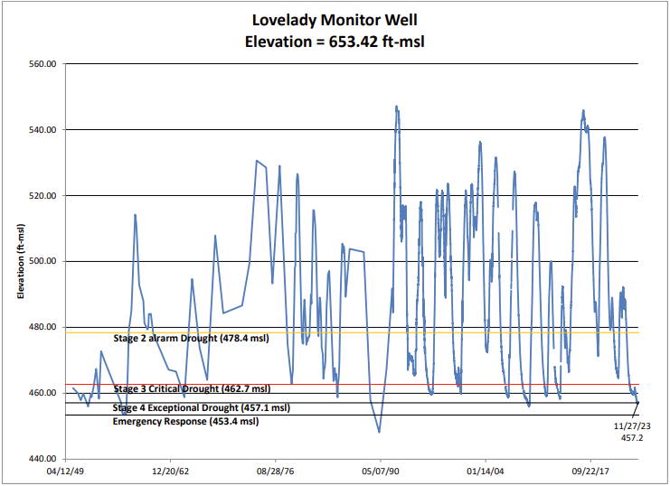
Figure 3. Lovelady monitor well groundwater level elevation since 1949