The Barton Springs-Edwards Aquifer Conservation District is a groundwater conservation district. The District is tasked by the Texas legislature to work with well owners to conserve and protect the Edwards and Trinity aquifers and groundwater resources within our territory. Our territory covers 430 square miles in parts of Travis, Hays, and Caldwell counties; home to about 400,000 people.

Our Mission
The District is committed to conserving, protecting, and enhancing recharge, preventing the waste of groundwater, and preserving all aquifers within the District.
Our Purpose
A groundwater conservation district (GCDs) is a local government entity, independent from cities or counties, created to protect aquifers and manage the use of groundwater. GCDs are granted authority in Chapter 36 of the Texas Water Code to manage groundwater production. Each GCD puts forth its own rules and regulations based on local aquifer conditions, economic factors, and enabling legislation.


Our Work
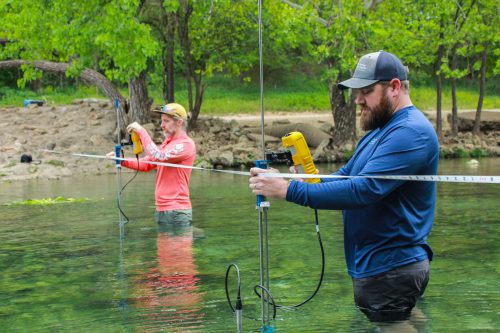
The District continuously monitors and studies the Edwards and Trinity aquifers to more effectively manage groundwater resources in the area. The District is also responsible for giving out permits for obtaining water from the aquifers and working with permittees to manage groundwater availability.
Our Territory
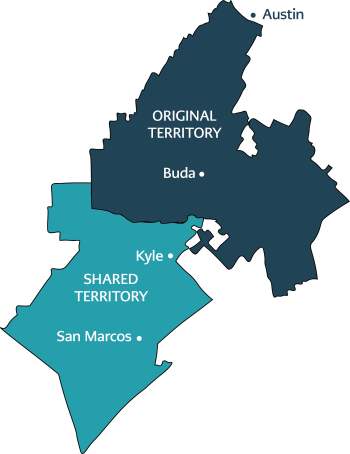
The District’s territory includes two smaller boundaries. Our Original Territory was set when the District was created in 1987 and extends from the Colorado River in Austin to northern Kyle. We are responsible for managing both the Edwards and Trinity aquifers in this area. In 2015, the District’s territory doubled and extended down to San Marcos. In this area, we manage the Trinity Aquifer while the Edwards Aquifer Authority oversees the Edwards.

1124 Regal Row
Austin, Texas 78748
© 2023 Barton Springs-Edwards Aquifer Conservation District