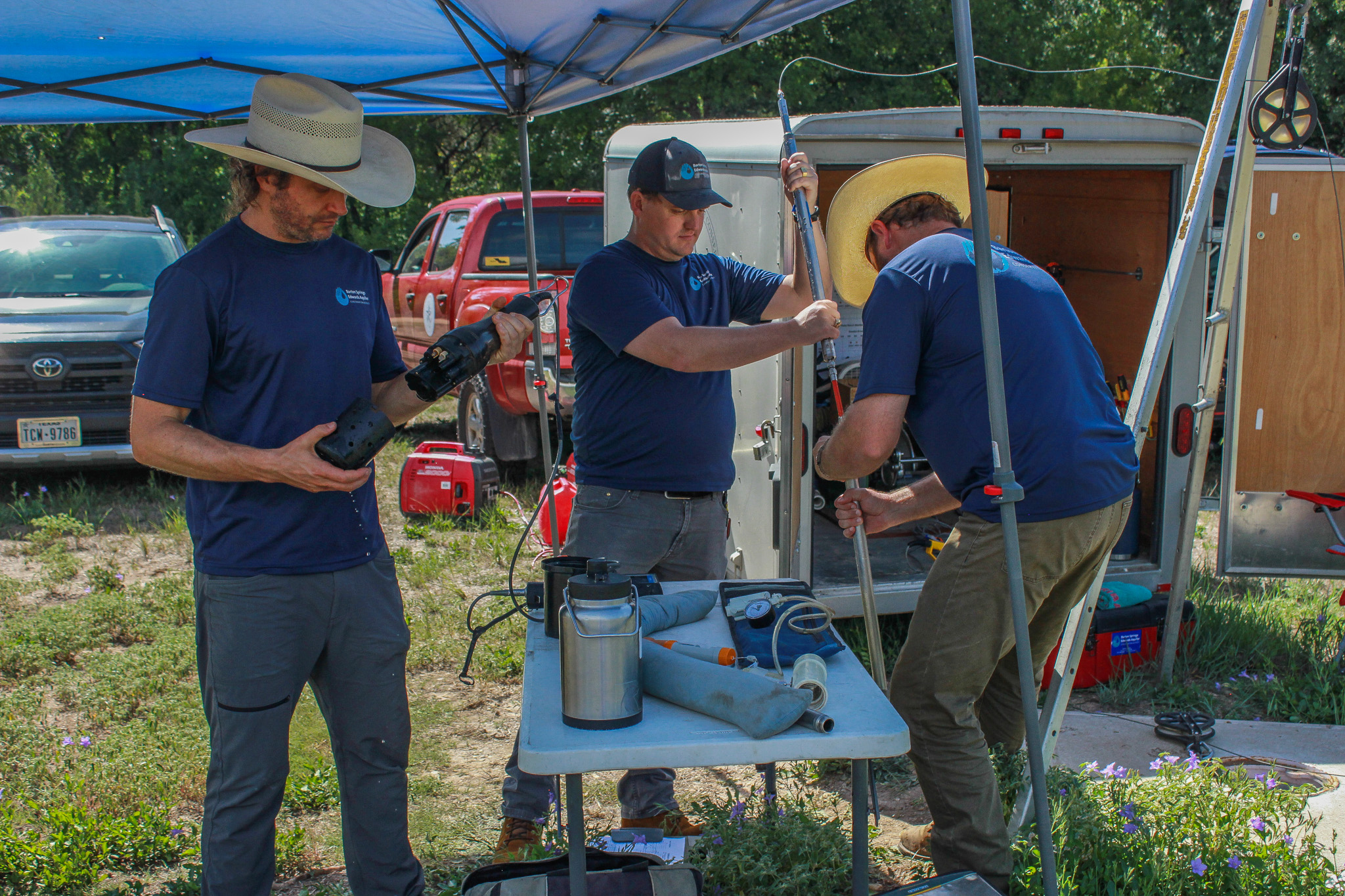
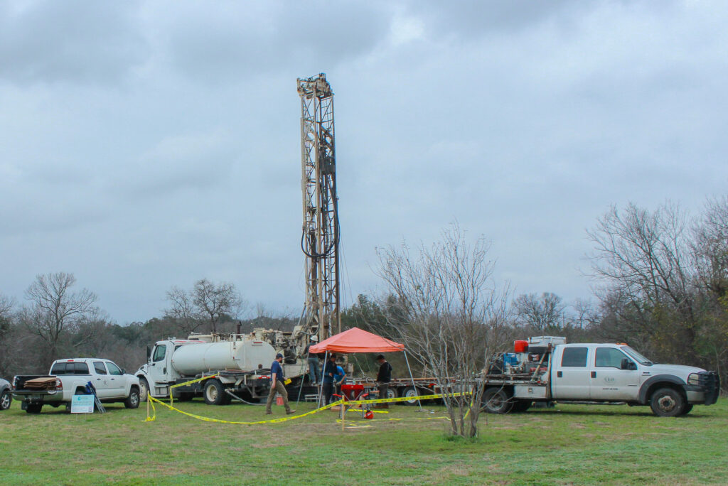
This July the District’s Aquifer Science team collected some of its first datapoints from the Barton Springs Multiport Monitor Well located in Zilker Park near Barton Springs Pool. While the well was drilled earlier this spring, the final stage of construction was completed in May when Westbay Instruments multiport equipment was installed.
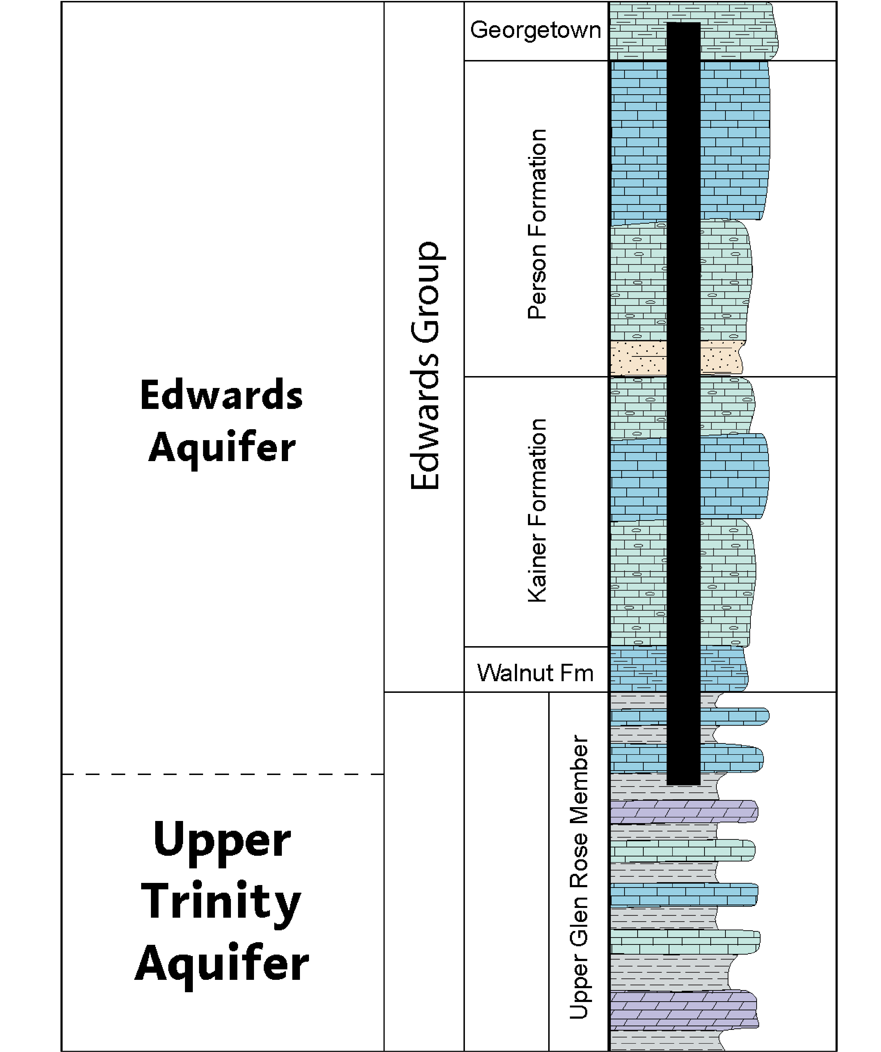
While a traditional monitoring well generally allows for the measurement of only one interval of an aquifer, this multiport well enables data collection at 14 different isolated zones. The data from this well is especially valuable because of its proximity to Barton Springs and the fact it spans over 538 ft through the entirety of the Edwards Aquifer and the top of the Trinity Aquifer, which lies beneath.
Last month at this well site, our Aquifer Science Team collected data on water pressure, levels, conductivity, pH, and temperature from each of the 14 zones. These field parameters will provide information on the water chemistry of the different segments of the aquifer; therefore, providing a better understanding of how much the zones communicate, or how the water moves between the zones, vertically within the aquifer.
In a few months, the United States Geological Survey (USGS) will join us in the field to collect water samples for more advanced laboratory analysis. These analyses will include tests for cations and anions, isotopes, and nutrients. This information will provide a more comprehensive understanding of water chemistry and likely flow paths and recharge within the Edwards and Trinity Aquifers next to the Barton Springs complex.
Visualizing the Aquifers
Below is a stratigraphic column of the Edwards and Upper Trinity aquifers. Stratigraphic columns show the vertical location of rock units in a particular area and typically show the sequence of sedimentary rocks, with the oldest rocks on the bottom and the youngest on top. In the graphic below, you can see where the Barton Springs Multiport Monitor Well begins and the formations it cuts through.