Background
Earlier this year, Austin City Council approved an innovative project to help recharge the Edwards Aquifer in the District’s territory and bolster Barton Springs flow. The Little Bear Recharge Enhancement Project will focus on diverting water from Little Bear Creek, located in southern Austin, in times of high flow and pushing it to a nearby former quarry. This project is the result of a partnership between several City departments, including Watershed Protection Department, Capital Delivery Services, and Austin Water. You might be wondering, “How can a quarry relate to groundwater and recharge?”
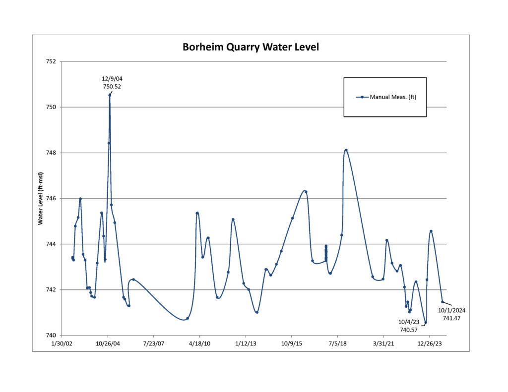
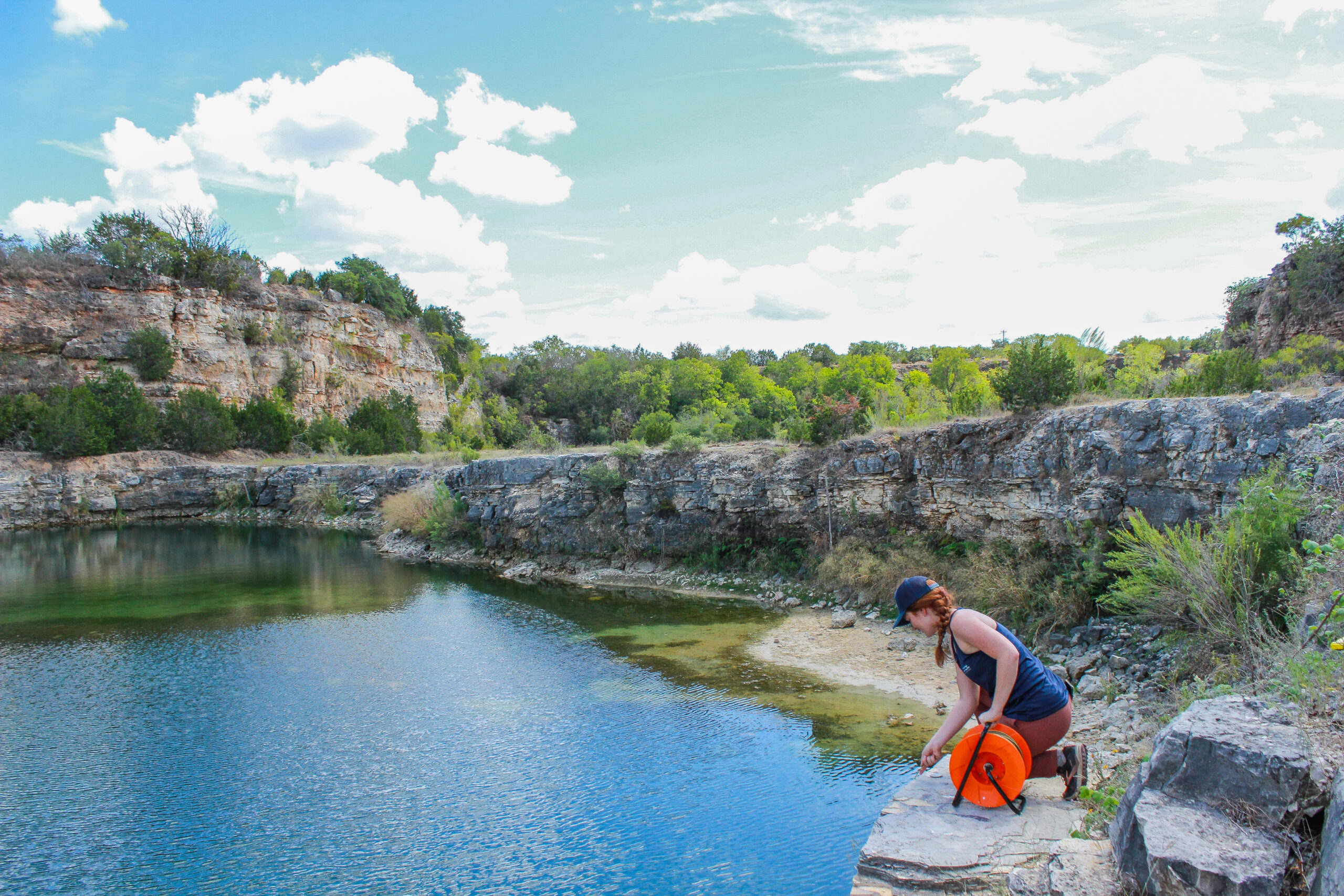
When this quarry was operational, the company dug deep enough that they incidentally hit the Edwards Aquifer. This resulted in groundwater filling the existing pit and forming a human-made body of water. This site and surrounding land have been used solely for conservation purposes by Austin Water since 2002, and the quarry pit along with the resulting pond serve as a valuable data collection point for the District.
Research at this Site
The District has collected groundwater level data from the quarry since 2002. Typically, our team measures groundwater levels by lowering a measuring tape down a well and recording the distance from the top of the well to the water surface below. However, at this site, we measure the distance from ground level down to the water’s surface in the pond.

Additionally, the City of Austin Watershed Protection Department conducted a dye tracing study at the site in 2017. Dye tracing is a common research method used by hydrogeologists to track and trace the flow of water underground. Researchers put non-toxic dye in the pond at the quarry, and they collected water samples at various places throughout the area to identify the exit point for the flow. As a result, Barton Springs was identified as a discharge point for the site.
Benefits of Project
With the water discharging at Barton Springs, and its proximity to Little Bear Creek, the pond and quarry are ideal for the Little Bear Recharge Enhancement Project. When completed, excess water diverted from the creek will enter the pond at the quarry. After travelling through the Edwards Aquifer over the course of approximately five days (depending on conditions), the water will discharge at Barton Springs.*
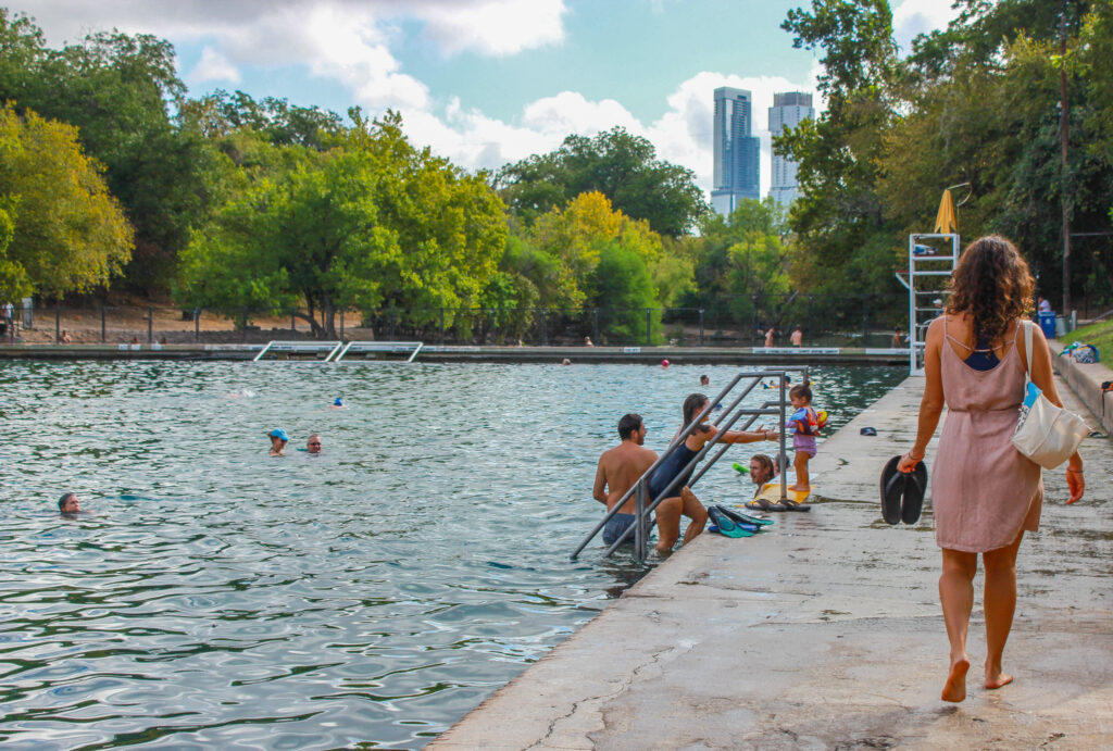
Maintaining flow at Barton Springs is significant because the City of Austin and District are required by U.S. Fish and Wildlife Services to protect the endemic and endangered species that live there — the Barton Springs and Austin blind salamanders. This unique project will help boost groundwater levels in portions of the Edwards Aquifer. It will also protect discharge at Barton Springs, benefiting not only pool visitors but also the salamanders that rely on the water for habitat.
* During a dye trace study in 2017, water from the quarry discharged at Barton Springs after five days while flow at the springs was 86 cubic feet per second (cfs). Flow at Barton Springs is currently under 20 cfs, so the water would likely take longer to travel this distance with these drought conditions.


