The drought persists in the Texas Hill Country, with the District remaining in Stage III. While February saw slightly above-average rainfall, it wasn’t enough to make a significant impact on the prolonged rainfall deficit that has accumulated over the past few years. Furthermore, March is expected to be warmer and drier than usual.
Rainfall
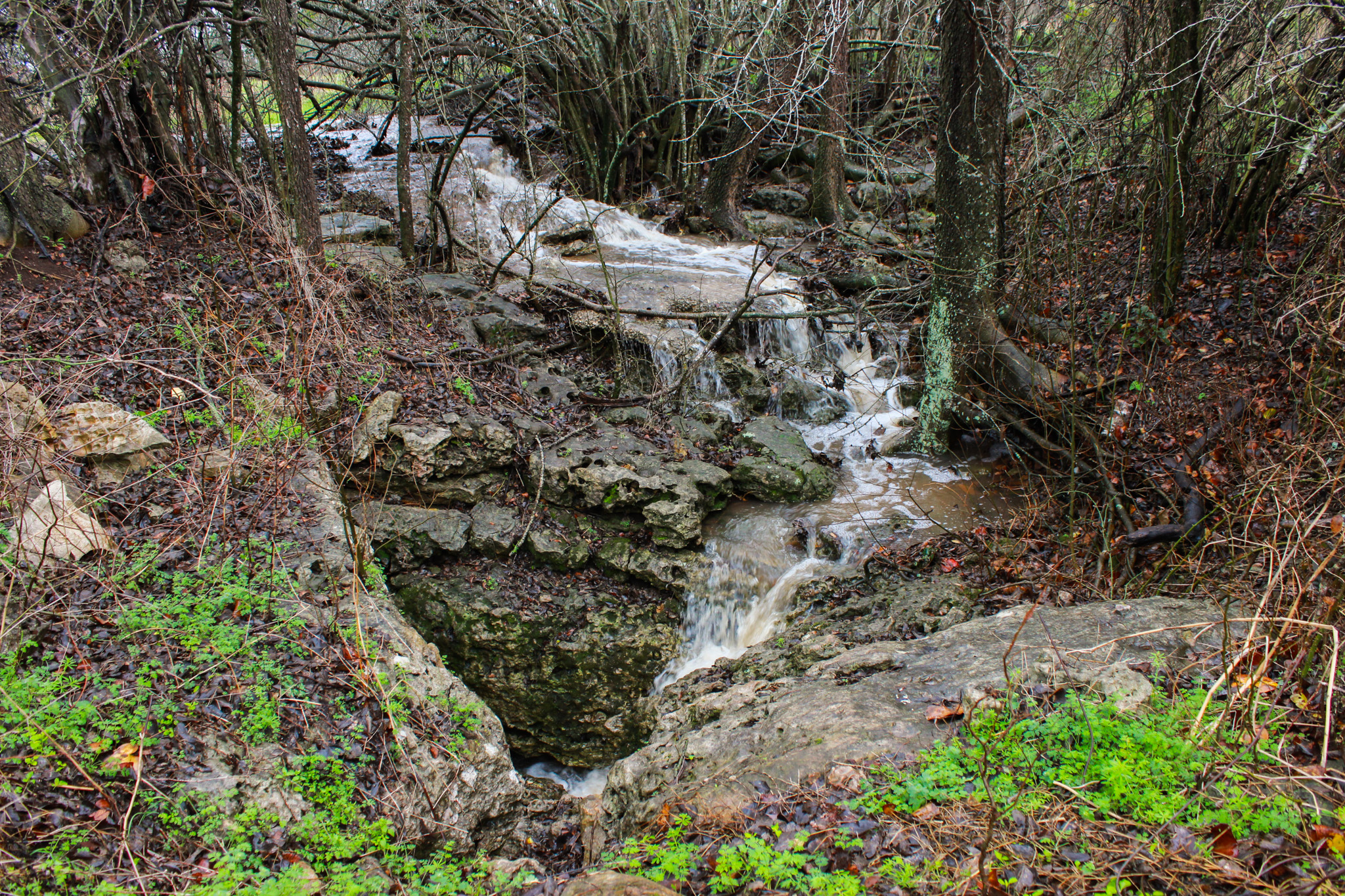
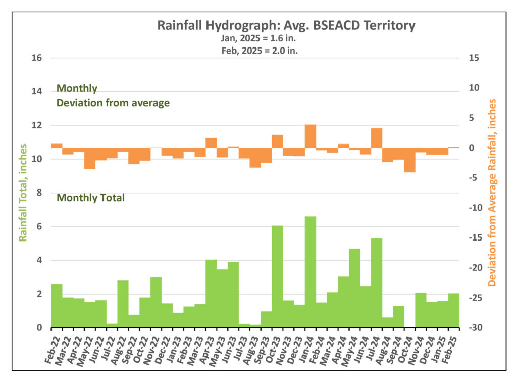
In February, the District received an average of just over two inches of rainfall (2.04 inches) with the majority occurring on February 11. This rain caused most area creeks to flow and provided much-needed recharge. Notably, February’s rainfall surpassed the historical monthly average of 1.9 inches, marking the first time this has happened since July 2024.
Drought Triggers and Status
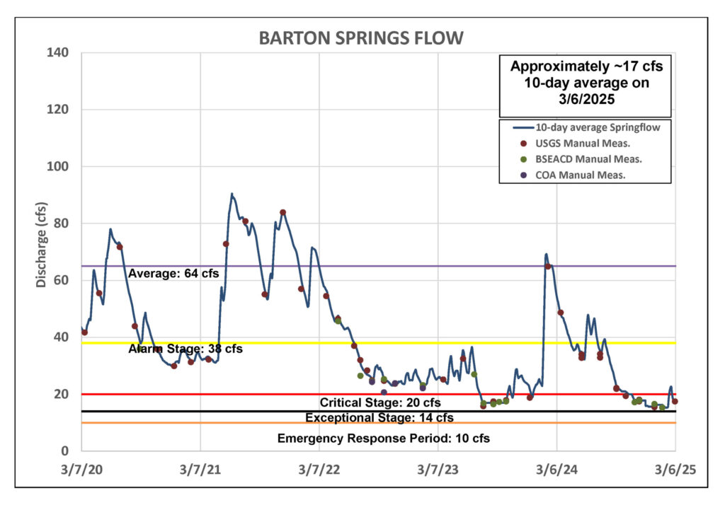
Barton Springs Flow
The heavy rainfall in mid-February fell across the recharge zone and generated flow in several area watersheds, including Onion, Bear, and Slaughter creeks. As a result, Barton Springs flow increased, peaking at 30 cubic feet per second (cfs). Since then, the flow has gradually decreased to around 17 cfs.
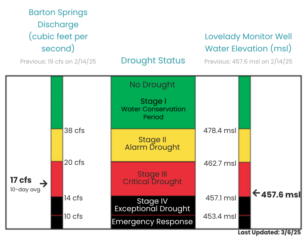
As of March 6, the 10-day average flow at Barton Springs stands at 17 cfs (Figure 2), based on the most recent manual measurement taken by the USGS on March 4, 2025.
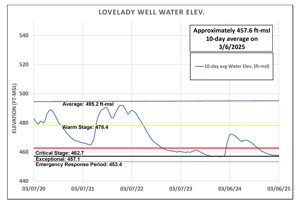
Lovelady Monitor Well
On March 6, the 10-day average water level at the Lovelady monitor well was recorded at 457.6 feet above mean sea level (ft-msl), placing it within the District’s Stage III threshold and approximately 0.5 feet above the Stage IV Exceptional Drought threshold (Figure 3). February’s rainfall did little to raise water levels, instead it temporarily stabilized them and delayed further decline. However, water levels have resumed their downward trend. Without additional rainfall, Lovelady could drop into Stage IV by the end of the month.
Trinity Aquifer
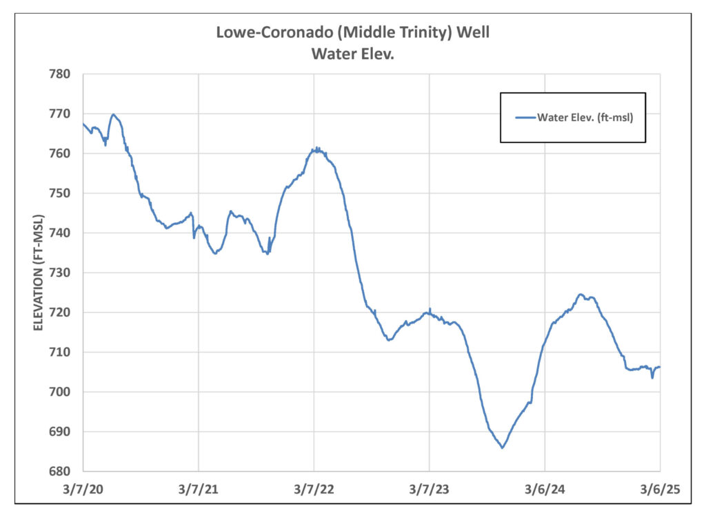
The water level in the Lowe-Coronado Middle Trinity monitor well, located in the Rolling Oaks neighborhood of Driftwood, remained stable from mid-November 2024 until early February 2025. Then a noticeable decline began—possibly due to localized pumping. However, the mid-February rains have since had a positive impact, leading to a gradual increase in water levels (Figure 4).
February’s rains caused a dramatic surge in flow at Jacob’s Well Spring (JWS), briefly reaching a yearly high of 16 cfs. Unfortunately, this increase was short-lived, and flow levels quickly returned to near zero. Meanwhile, the Blanco River at Wimberley gauge saw a rise from 7 cfs to 90 cfs, before settling into a steady flow of 8 to 9 cfs—a range that has remained consistent since mid-November.