To better understand and manage groundwater in the Trinity Aquifer, the District operates the Coleman’s Canyon Multiport Monitor Well, located in central Hays County. Drilled in 2022, this advanced well system reaches a depth of 535 feet and includes ten distinct monitoring zones.
This well is a key tool in characterizing the complex Trinity Aquifer system and understanding how water moves between its hydrogeologic units. These insights are important for sustainably managing the Trinity Aquifer.
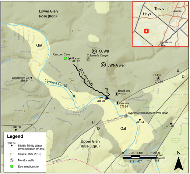
Geologic map of the area around Jacob’s Well (JWS) including the conduit (cave passage), shown with a heavy black line, which directs much of the flow to Jacob’s Well. The multiport well at Coleman’s Canyon (CCWB) and the dual completion well (JWNA- Jacob’s Well Natural Area) are shown to the north of Jacob’s Well. Gray lines are faults.
Monitor Wells and Aquifer Data
Find more information on how the District monitors the Edwards and Trinity aquifers and groundwater levels.