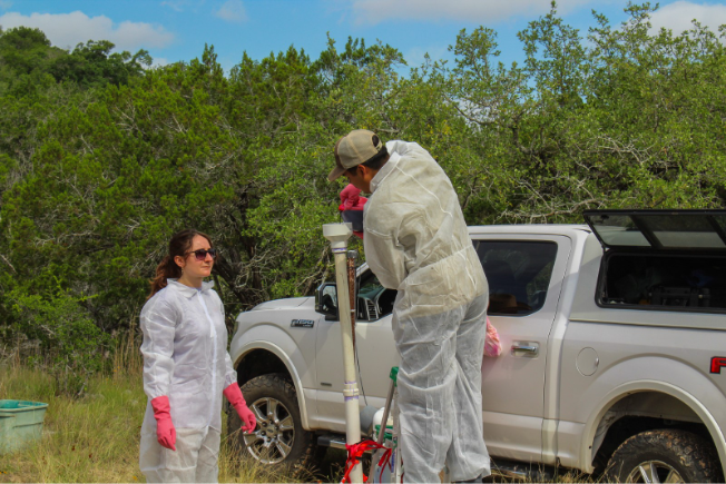
Students researchers from The University of Texas pour eosine dye into a well adjacent to Hamilton Creek in Travis County.
If you’ve ever swum at Barton Springs, you’ve felt the cool, constant water without ever seeing where it comes from. Every drop has traveled through an invisible path underground before rising to the surface. Figuring out where it comes from, how fast it moves, and how it connects to the world above is one of the central challenges of aquifer science.
But understanding what lies underground requires more than observation – it requires tracer experiments.
How did researchers figure out the speed, path, and connectivity of groundwater flow? The answer lies in dye tracing!
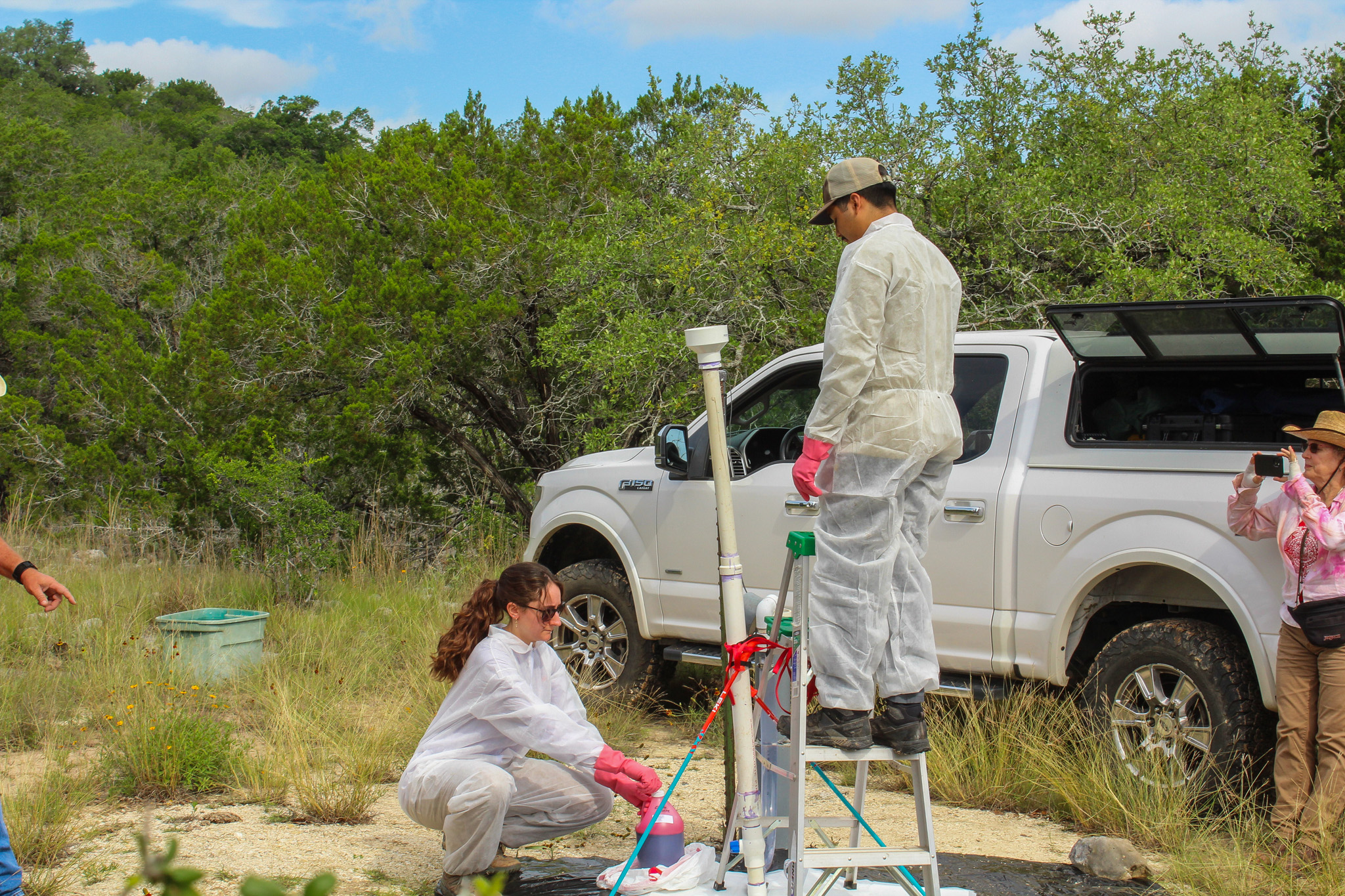
Dye tracing tracks groundwater flow by introducing fluorescent, non-toxic dye into a system and monitoring its movement. This technique has been used across the region for decades to map the hidden connections between sinkholes, streams, and springs. Karst systems are fractured limestone landscapes where water moves through cracks and cavities. These systems, such as the Edwards and Trinity aquifers, are particularly well-suited for dye tracing experiments. Hydrogeologists and student researchers from The University of Texas Jackson School of Geosciences gathered near Hamilton Pool Preserve on May 26, 2026 to conduct a dye trace. The students gained firsthand experience in a technique that is central to understanding how the aquifer behaves and how to best protect it. An existing shallow well served as the dye introduction point.
For this trace, the researchers used eosine dye, which has a red hue. The previous dye trace in this area used fluorescein, a green-hued dye. Using different dyes in succession is essential so that detections of the new dye are not confused with residual traces of the old one. The longevity of dye can vary drastically. One well in San Marcos has detected dye from a previous study consistently for nearly eight years.
Below is a photo from 2017 when the District facilitated a dye trace at Borheim Quarry — a monitoring site for the District. That trace indicated that Borheim Quarry may be a significant recharge contributor to Barton Springs Pool.

With that history in mind, the team set to work preparing the injection. The researchers had to calculate how much dye to use based on the expected volume of water moving through the system. Too little dye and it may go undetected. Too much and it could prove inconclusive results. Half a pound of powdered eosine dye was diluted into one gallon of water – an extremely diluted amount that’s roughly equivalent to a few drops in an Olympic-sized swimming pool.
The student researchers poured the diluted dye into the shallow well, rinsing the container with water and continuously pouring the rinse into the well to ensure all of the dye was used. Following the injection, 8,000 gallons of water were pumped into the well to flush the dye deeper into the system and increase the hydrologic gradient. This essentially created a strong push to move the dye through the aquifer more quickly and consistently.
With the dye in the ground, the waiting begins. Mesh pouches containing activated charcoal are placed near known springs. Leaving the pouches in the water for hours, days, and weeks allows them to continuously capture dye that might be missed by point-in-time water sampling. The charcoal absorbs dye from the flowing water and releases it during laboratory analysis. To reduce the risk of cross-contamination, the students who injected the dye did not participate in the charcoal collection process.
Results from the trace are expected within the next week or two. If the eosine dye is detected at any of the charcoal packets, it will help confirm the flow path and timing of groundwater moving through this stretch of the Trinity Aquifer. This will help add another piece to the puzzle of how our groundwater resources are connected, sustained, and ultimately protected.