For almost four decades, the District has protected the Edwards and Trinity aquifers in our region. We’re responsible for managing groundwater to ensure there’s adequate resources available for the well owners and permittees in our territory now and for years to come.

Founding of the District
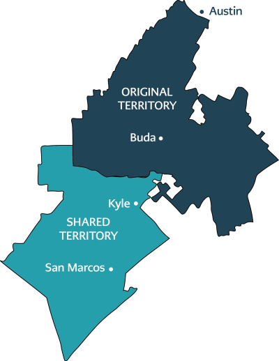
The Barton Springs-Edwards Aquifer Conservation District was created by the Texas Legislature in 1987 with the passage of Senate Bill 988. The Original Territory extended from south of the Colorado River in Austin to northern Kyle and included 247 square miles. SB 988 gave the District oversight of both the Edwards and Trinity aquifers within this boundary.
Historically, groundwater in the area was mainly used for farming, ranching, and rural domestic use. Over the years, the land increasingly converted into a residential area. Groundwater is now mainly utilized for domestic and public water-supply purposes with smaller amounts being withdrawn for commercial, non-agricultural irrigation, and industrial use.
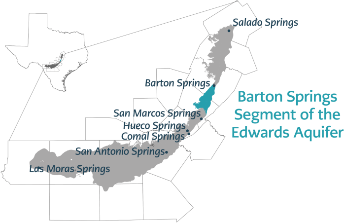
The territory includes the Barton Springs segment of the Edwards Aquifer, which is the water source for Barton Springs Pool in Austin. Discharged groundwater from the springs provides critical habitat for Austin blind and Barton Springs salamanders, which are both endangered and endemic species.
Territory Expansion
In 2015 the passage of House Bill 3405 expanded the District’s jurisdiction to include a portion of the Trinity Aquifer that was previously unregulated. Extending from northern Kyle to southern San Marcos, this addition nearly doubled the District’s territory. Including this area the District now oversees drinking water for nearly 100,000 community members.
Within the new Shared Territory, the Edwards Aquifer is managed by the Edwards Aquifer Authority as it was prior to HB 3405. The house bill gave the District oversight of Trinity Aquifer in this area in addition to its Original Territory.
The considerable population growth and development throughout this southern area means there is much work to be performed to improve understanding of the three layers of the Trinity Aquifer.

