March 20th marked the first day of spring, bringing the sun higher in the sky for longer days with budding wildflowers. We can “spring forward” and leave the cold and dry behind right? Well, partly. While the weather is getting warmer, strengthening La Niña conditions indicate it may also be getting drier. According to the National Oceanic and Atmospheric Administration (NOAA), La Niña built up strength in February and is favored to continue into the summer 2022. This means that we are predicted to receive below average rainfall and above average heat through May-June, which are historically the wettest months of the year in central Texas.
The Texas Hill Country has received an average of 5 inches – 4 inches behind annual average rainfall – from January through early April.
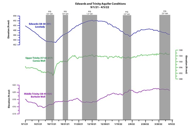
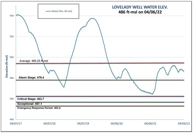
The impact of drier-than-usual conditions on regional aquifers can be seen in Figure 1 below. Water levels in the Edwards showed a short-lived rise after some late January rains provided some recharge. Trinity water levels also displayed a delayed rise in response to late 2021 rain. However, those rising levels are slowing down.