Recent Additions:
| Generalized Aquifer Stratigraphy | Monitoring Effort Status Map |
 |
 |
On this page:
The Barton Springs/Edwards Aquifer Conservation District (BSEACD) Board and staff are tracking Trinity Aquifer well drilling activity just south of the District boundary. While the test wells are within the Edwards Aquifer Authority (EAA) boundaries, the EAA has no regulatory authority over the Trinity Aquifer. Electro Purification, LLC is investigating the feasibility of pumping a large volume of water to supplement water supplies for Goforth SUD, Buda, and Anthem residents. The BSEACD Board and staff are looking into the quantity of water proposed for withdrawl, local aquifer characteristics, and possible effects of the withdrawls on permitted wells within the District.
This Spotlight is provided as transparent way to store information used during the District’s review of the project. This project has been highlighted through several news outlets. The District is collaborating with neighboring groundwater conservation districts, policy experts, and groundwater professionals during the review of the project.
Documents
Presentation to Hays County Commissioners: Status of Central Hays County Groundwater Evaluation (Apr 7, 2015, pdf)
BSEACD Update on Electro Purification Project, Issac Town Hall (Feb 10, 2015, pdf)
BSEACD Presentation on Electro Purification Project, Board Meeting (Jan 29, 2015, pdf)
Conceptual Cross-Section of Initial 3Test Wells of Interest (pdf)
Trinity Modeled Available Groundwater Volumes and Electro Purification Production Volumes (pdf)
Maps
| Description | Map |
|---|---|
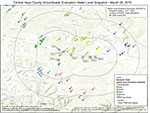
| March 2015 Water Level Snapshot – PRELIMINARY data
This map summarizes the ~65 water level measurements made from 3/16 – 3/20. Water level measurements have been converted into water level elevations. Data need to be further refined using well depth, well completion, and location. This is a preliminary summary of the data collected as part of the collaborative (HTGCD, PCCD, EAA, BSEACD) March 2015 Water Level Snapshot. |
 |
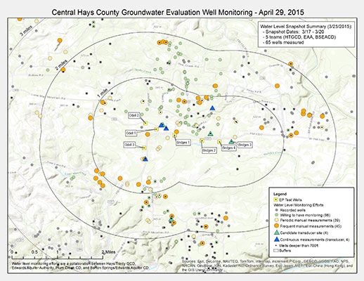
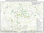
| Well Monitoring Summary March 26, 2015The water level snapshot initiative was very successful. About 65 wells were measured in 4 days. |
 |
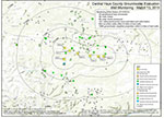
| Central Hays County Groundwater Evaluation Well Monitoring March 13, 2015A water level snapshot is planned for March 18-20, 2015. Collaborating GCD staff will be trying to visit as many wells as possible to help establish a baseline water level in the area. Staff will be travelling in well marked vehicles and will contact well owners to ask permission before arriving. |
 |
| Central Hays County Groundwater Evaluation Well Monitoring Feb. 27, 2015This map shows a first look at candidate sites for water level transducers. After many site visits, research on drillers logs, and analysis of geophysical logs, here’s a first cut at possible sites that could be monitored with water level transducers. Hydrogeologists are still checking into feasibility at each site and are trying to narrow the list down to the key locations that can measure both shallow and deep wells at a variety of distances and directions from test wells.This map provides a snapshot of the collaborative monitoring effort underway. Current efforts include base line water level measurements and evaluation of wells for frequent or transducer (automatic) water level monitoring. |
 |
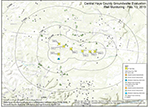
| Central Hays County Groundwater Evaluation Well Monitoring Feb. 19, 2015Many thanks to the well owners that have contributed their information. We have visited 26 wells, taken a total of 47 water level measurements, heard from 114 landowners, and have increased the number of recorded wells in the area to over 600. Given there are 1500+ groundwater-supplied properties in the area, this is a small sample of the wells known to be in the area.This map provides a snapshot of the collaborative monitoring effort underway. Current efforts include base line water level measurements and evaluation of wells for frequent or transducer (automatic) water level monitoring. |
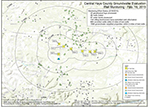 |
| Central Hays County Groundwater Evaluation Well Monitoring Feb. 13, 2015This map provides a snapshot of the collaborative monitoring effort underway. Current efforts include base line water level measurements and evaluation of wells for frequent or transducer (automatic) water level monitoring. |
 |
| Properties and water utilities in relation to test well locations. There is no surface water supplied water utility within 2 miles, so properties are assumed to rely on groundwater as the sole water source either through private wells or groundwater-supplied water utilities. | 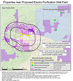 |
| Test Well Locations in relation to Groundwater District boundaries. | 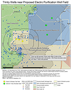 |
| Extent of Trinity Aquifer within Hays County | 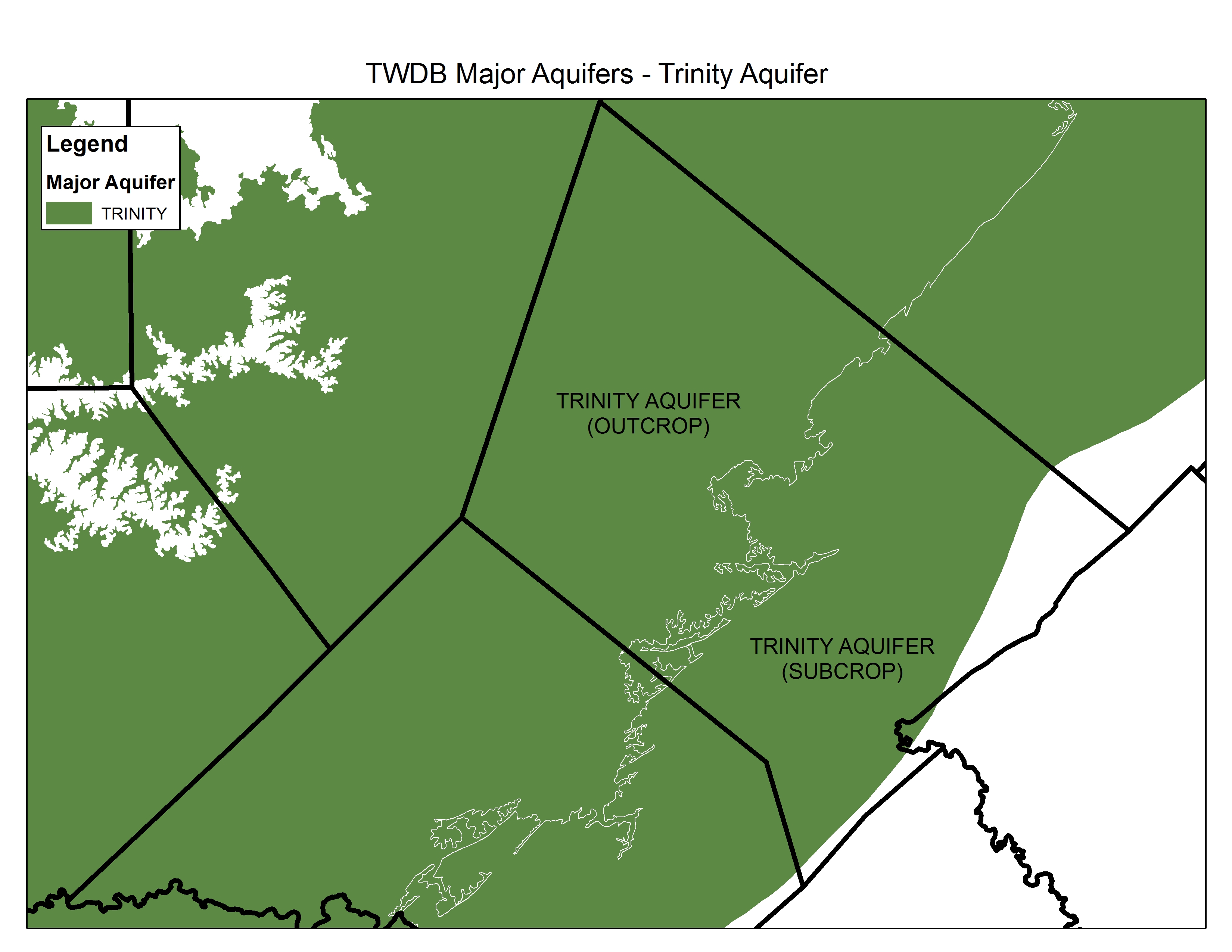 |
| Extent of Trinity Aquifer within Hays County with Groundwater Conservation Districts | 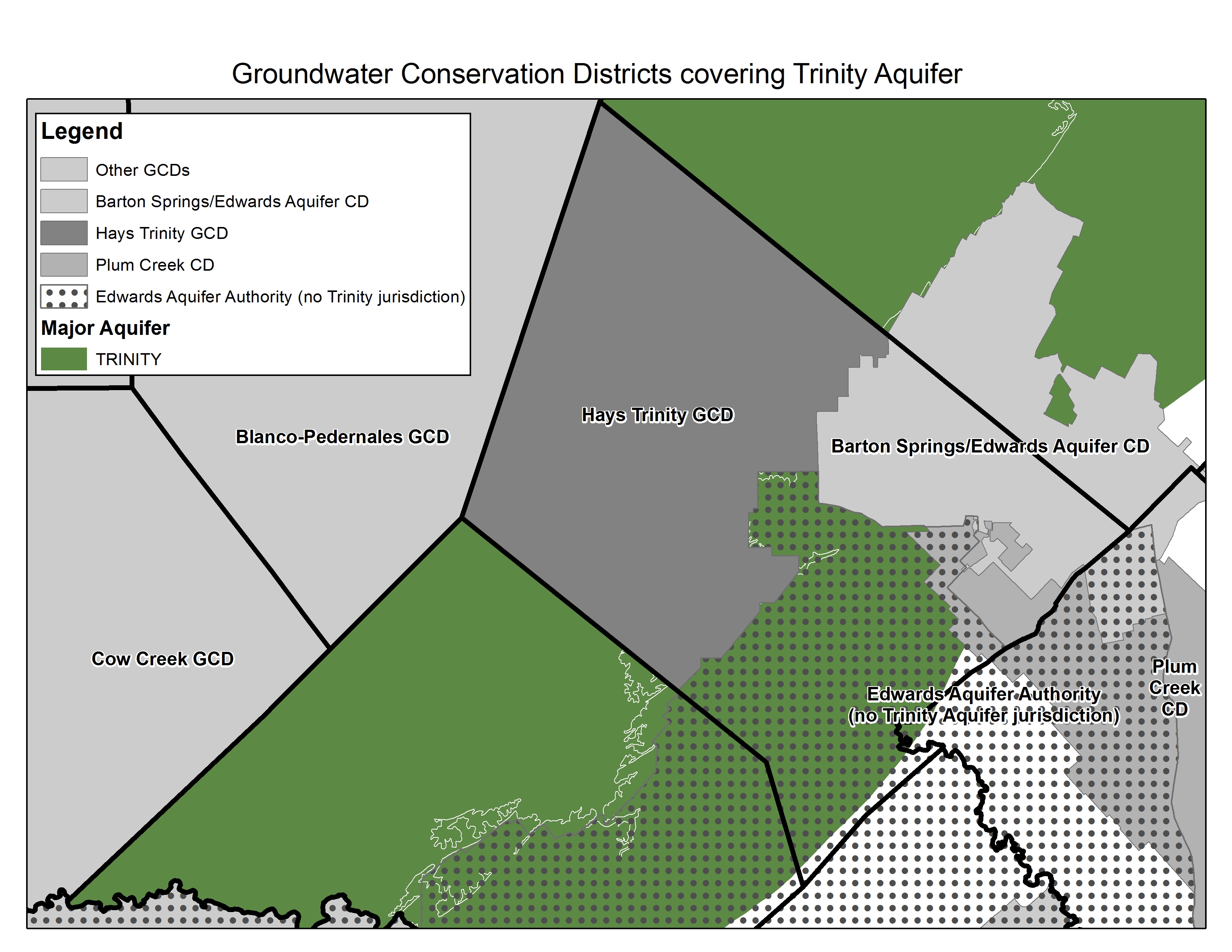 |
| Extent of Trinity Aquifer within Hays County with Groundwater Conservation Districts relative to Trinity Aquifer test wells of interest |  |
Find Your Well Report
This is intended for folks looking for information on their water wells that were drilled before 2003.
The general TCEQ Water Well Reports site.
However, here are the scans of old records that are plotted by general well driller’s grid that folks can scan through looking at previous owners, addresses etc.
Select “Plotted Well Reports” then search by Grid number. Selected Grid numbers are below:
- Rolling Oaks and some of Lon Man Mnt road: (Grid 57-64-6)
- Las Lomas wells: (Grid: 57-64-9)
- About Deer Lake road toward Wimberley to the SW (Grid: 57-64-8)
- Lone Man Mnt Road to the north and west (Grid: 57-64-5)
