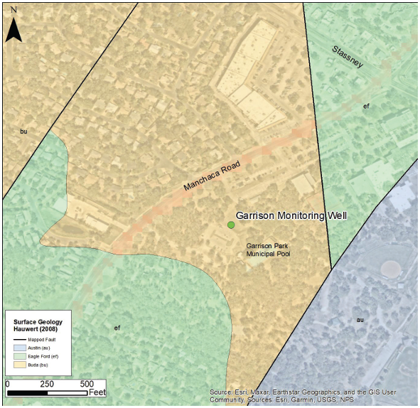
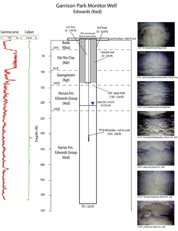
The Garrison Monitor Well, drilled in 2024 near Garrison Park in South Austin, extends to a depth of 524 feet into the Edwards Aquifer. This site supports ongoing scientific research and data collection, with telemetered monitoring systems providing real-time measurements of key water quality parameters, including dissolved oxygen, conductivity, and turbidity. Continuous water level logging is also conducted to support hydrological analysis and aquifer management efforts.
The Garrison Well site was chosen to help monitor the Edwards Aquifer in a part of the Manchaca Groundwater Basin where groundwater tends to flow in longer, northeast-trending paths. These paths can quickly carry groundwater to the Barton Springs Complex and are likely connected to a major conduit system. Because of this, the Garrison Monitoring Well serves as an important spot for keeping track of aquifer conditions and water quality over time.
Schematic of Garrison Well Completion with Gamma/Caliper curves and selected downhole camera screenshots.
Monitor Wells and Aquifer Data
Find more information on how the District monitors the Edwards and Trinity aquifers and groundwater levels.